

Drone surveying and mapping across large sites and long corridors
Last updated: 18 November 2026
Jabali is a fixed-wing VTOL survey drone for high-coverage drone surveying, photogrammetry and 3D modelling. It takes off vertically from the site, with no runway, then flies efficient, overlapping survey lines on the wing with camera, LiDAR or multispectral payloads and RTK or PPK positioning for survey-grade, georeferenced output.
Every Jabali is supplied and integrated by Helvetis and configured around your survey deliverables.
Capabilities
01
High-coverage in one flight
Wing-borne endurance maps large areas and long corridors per sortie, far beyond a multirotor, while launching vertically from the site, so a survey that once took many flights can be done in one.
02
Survey-grade accuracy
RTK and PPK workflows deliver centimetre-level, georeferenced output for survey, mapping, volumetrics and 3D modelling, suitable for professional deliverables.
03
Access from anywhere
Vertical take-off needs no runway, so confined, remote or rough sites are surveyable without ground infrastructure, launch rails or a recovery area.
04
Repeatable datasets
Consistent flight lines and georeferenced imagery support change detection and progress monitoring over time, so repeat surveys compare cleanly.
Cover more ground per drone survey
Surveying from the air has always meant trading coverage against access. Multirotor drones launch from anywhere on site but cover only a small area per battery, so mapping a large quarry, corridor or development means many flights and a long day. Fixed-wing survey aircraft cover ground efficiently but need a runway or hand-launch and a clear area to belly-land, which many sites cannot offer. A fixed-wing VTOL survey drone removes the compromise: it lifts off vertically from the site, flies efficient, overlapping survey lines on the wing, then lands vertically in the same spot.

For survey teams, that means more area mapped per flight and access to sites that conventional fixed-wing cannot use. The aircraft flies planned, repeatable lines and captures georeferenced imagery, which feeds straight into photogrammetry and mapping software. Overlap matters the way stripes matter when mowing a pitch: miss it and the gaps only show once the map is stitched. With RTK and PPK, the output reaches centimetre-level accuracy, and because the flight plan is repeatable, successive surveys line up for volumetrics and change detection across a project.
Why a fixed-wing VTOL UAV for drone surveying
Drone surveying rewards area coverage and accuracy. Multirotors are easy to launch but cover little ground per battery, while fixed-wing survey aircraft cover ground but need a runway or launcher and a recovery area. A fixed-wing VTOL UAV like Jabali removes that compromise: it takes off vertically from the site, then flies efficient, overlapping survey lines on the wing, carrying mapping sensors with RTK and PPK for survey-grade, centimetre-level output.
Survey teams cover more per flight, reach sites that conventional fixed-wing cannot, and build repeatable datasets for mapping, volumetrics and 3D modelling. Because it is delivered as an operating capability, the sensors, endurance and mapping workflow are matched to your site and accuracy targets, and Helvetis provides the training and support to run it, so the team can survey independently.
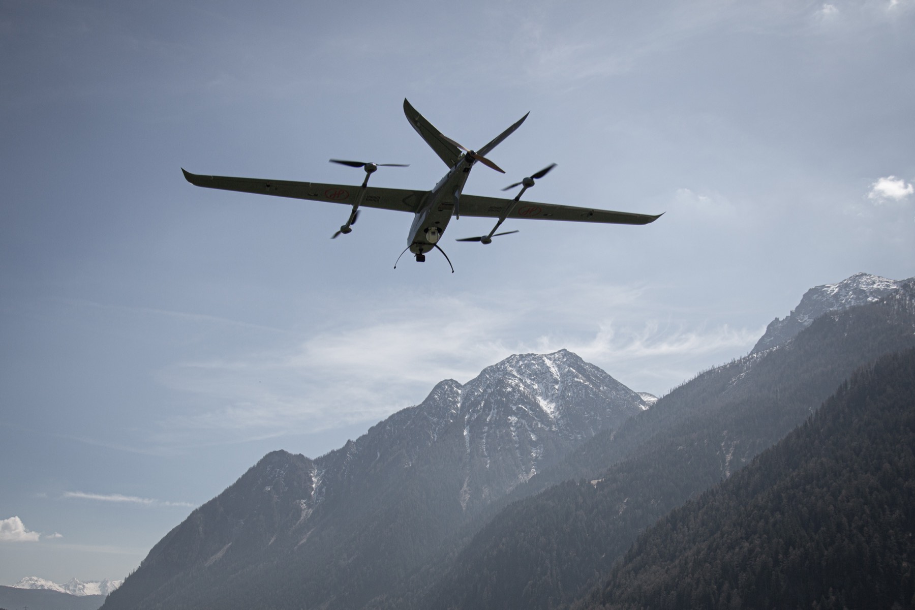
Configure the survey drone for accuracy, GSD and deliverables
Survey requirements vary by site and deliverable, so the configuration is defined by the area, ground sampling distance (GSD), terrain, accuracy targets and expected outputs. Helvetis matches camera, LiDAR or multispectral payloads with RTK or PPK positioning and the right flight and processing workflow, whether the job is drone land surveying, corridor mapping, topographic survey, volumetrics or 3D modelling.
The system is tested as one capability and handed over with training so your team can plan flights, fly them and produce deliverables independently. Indicative figures across the Jabali family appear in the spec table, with final specifications confirmed at configuration and a detailed datasheet available on request. Helvetis supports the capability across its life as your survey programme grows.
Sensors, accuracy and deliverables
Survey results depend on the sensor and the ground control behind it. As a fixed wing mapping drone with vertical take-off, Jabali carries photogrammetry and LiDAR payloads, with RTK and PPK workflows that deliver centimetre-level, georeferenced accuracy. The sensor and processing chain are chosen for the deliverable you need, from orthomosaics and digital surface models to point clouds, contours and volumetrics.

Because the aircraft flies planned, overlapping lines, the imagery drops straight into standard photogrammetry and mapping software. Consistent flight plans mean repeat surveys align cleanly, which is what makes volumetric tracking and change detection reliable across a project, a quarry or a construction site over months.
The output is built to fit existing survey and GIS workflows rather than to sit in a silo. Helvetis configures the platform, sensor and processing around your accuracy targets and the way your team works, and provides the training and support to produce deliverables in-house, so surveying with the aircraft becomes routine rather than a specialist exercise.
Configured for surveying
Sensors, endurance and mapping workflow are matched to your site and accuracy targets.
- Endurance
- 3 to 10 h
- Range
- 245 to 850 km
- Payload
- 4 to 10 kg
Final figures confirmed at configuration.
Jabali platform variants


|
Jabali E
Electric
Portable · routine missions |
Jabali EX
Electric
Heavy payload · extended reach |
Jabali X
Hybrid fuel
Long endurance · wide area |
|---|---|---|
| 210 | 240 | 600 |
| 245 | 280 | 850 |
| 4 | 10 | 8 |
| 3.4 | 3.9 | 4.0 |
| 70 | 72 | 85 |
| 110 | 130 | 130 |
| 16 | 28 | 30 |
| 20 | 38 | 45 |
| 3500 | 4500 | 3000 |
| 13 | 13 | 13 |
| -10 to 60 | -10 to 60 | -10 to 60 |
| IP54 | IP54 | IP54 |
| Waterproof | Heated, waterproof | Heated, waterproof |
| 3378 × 1500 × 500 | 3914 × 1937 × 712 | 4000 × 2056 × 767 |
Final specifications depend on payload, conditions and configuration.
Questions
A fixed-wing VTOL survey drone takes off vertically, then flies efficient survey lines on a fixed wing.
It maps large sites and long corridors per flight without a runway. Jabali carries mapping sensors with RTK and PPK to produce survey-grade, centimetre-level, georeferenced output for surveying, mapping and 3D modelling.
With RTK and PPK workflows, fixed-wing VTOL survey drones reach centimetre-level accuracy suitable for professional survey, mapping and volumetrics.
Actual accuracy depends on ground control, the sensor and flight parameters. Jabali is configured around your accuracy targets, and figures are confirmed for your chosen configuration.
For large areas and long corridors, a fixed-wing VTOL survey drone covers far more ground per flight than a multirotor while still launching vertically from the site.
Wing-borne endurance lets Jabali survey large sites in a single sortie; exact coverage depends on the platform, sensor, altitude and overlap, and is confirmed for your configuration.
With mapping sensors and RTK or PPK processing, Jabali captures georeferenced imagery that feeds photogrammetry software to produce orthomosaics, digital surface and terrain models, point clouds, contours, volumetrics and 3D models.
The exact deliverables depend on the sensor and workflow chosen for your project, and the configuration is defined with you and confirmed for your accuracy targets.
Yes.
Wing-borne endurance is what makes high-coverage surveying practical: Jabali flies long, overlapping lines across large sites and long corridors in a single sortie, well beyond a multirotor. Exact coverage depends on the platform, sensor, altitude and overlap, and is confirmed for your configuration, but the design is built to map more area per flight with repeatable, georeferenced datasets.
For small, detailed sites a multirotor is fine, but for large areas and long corridors it is slow, needing many flights and battery swaps.
A fixed-wing VTOL survey drone covers far more ground per flight while still launching vertically from the site, so it suits the high-coverage mapping where a multirotor becomes impractical. The right choice depends on the size of the site and the deliverable.
Drone surveying with a fixed-wing VTOL platform suits mining and quarrying, construction and earthworks, land and cadastral survey, agriculture, forestry, and corridor mapping for roads, rail and utilities.
Any work that needs accurate, repeatable coverage of a large area or long corridor benefits, and the platform is configured around the deliverable each sector needs.
Corridor mapping is a strong fit.
Wing-borne endurance lets Jabali fly long, continuous lines along a road, railway or pipeline route in one sortie, capturing overlapping, georeferenced imagery for accurate strip maps and 3D models. Vertical take-off means it can launch from an access point on the route, so even remote corridors are surveyable without a runway.
It depends on the area, terrain, deliverables and accuracy targets.
Cost per hectare falls as coverage grows, because a fixed-wing VTOL survey drone maps far more area per flight and per day than a multirotor. Owning the capability is a configured investment rather than a list price: Helvetis prepares a quotation around your sites and deliverables, with the platform, sensor and support priced as one system.
Photogrammetry produces orthomosaics, textured 3D models and accurate surfaces where the ground is visible, and it is usually the more economical choice.
LiDAR penetrates vegetation, maps under canopy and delivers dense point clouds in low-texture terrain, at a higher payload cost. Many programmes use both: photogrammetry for routine coverage, LiDAR where vegetation or precision demands it. Jabali carries either payload, and Helvetis configures the right chain for your deliverables.
Jabali systems start from USD 80,000 ready to fly, ex works and before shipping, taxes and training.
For surveying and mapping, the final price depends on the variant, the mapping sensor, the datalinks and the quantity, so every enquiry receives a written quotation matched to the mission.