

Infrastructure and pipeline inspection: long corridors, one flight
Last updated: 18 November 2026
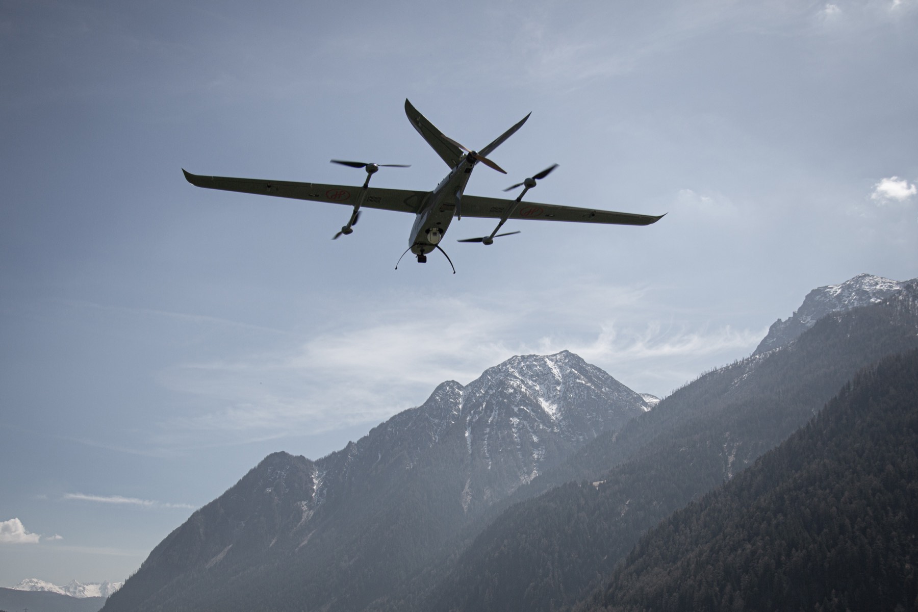
Jabali is a fixed-wing VTOL drone for pipeline, power line and infrastructure inspection. It takes off vertically from an access road or station, with no runway, then flies efficient, long-corridor passes on the wing, carrying high-zoom optical, thermal, mapping, LiDAR and specialised sensors to detect leaks, encroachment and damage.
Every Jabali is supplied and integrated by Helvetis and configured around your assets and inspection cycle.
Capabilities
01
Long-corridor coverage
Wing-borne endurance inspects long runs of pipeline, power line and infrastructure in one flight, without the short legs and repeated battery swaps a multirotor needs over a linear asset.
02
Inspection-grade sensors
High-zoom optical, thermal and specialised payloads detect leaks, hotspots, corrosion, encroachment and physical damage across assets, including oil and gas networks.
03
Access without infrastructure
Vertical take-off from access roads, stations and pads means no runway, so remote, constrained or hard-to-reach sites along the corridor stay reachable.
04
Repeatable, georeferenced data
Mapping options with RTK and PPK and georeferenced imagery support change detection and reporting between passes, building a consistent record of each asset over time.
Drone pipeline inspection across long and remote corridors
Linear assets are awkward to inspect. Pipelines, power lines, rail and roads run for tens or hundreds of kilometres, often across terrain with no airfield nearby. A multirotor can launch at any access point but only covers a short leg before it has to land and recharge, so inspecting a long corridor means many flights and a lot of ground travel between them. It is like checking a railway line on foot when you could ride it end to end. A conventional fixed-wing aircraft has the range but needs a runway or launcher and a recovery area, which rarely exist along the asset.

A fixed-wing VTOL drone resolves this. It launches vertically from an access road, valve station or substation, climbs out, then flies the corridor efficiently on the wing, covering far more asset per sortie before returning to a precise vertical landing. Crews inspect more line per day, reach sections that ground crews struggle to access, and capture consistent, georeferenced imagery that makes year-on-year comparison straightforward.
Why use a fixed-wing VTOL drone for infrastructure inspection?
Linear assets like pipelines and power lines reward range and endurance, which favours fixed-wing flight, but inspection sites are rarely near a runway, which favours VTOL. A fixed-wing VTOL drone like Jabali combines both: it takes off vertically from an access road or station, then flies efficient, long-corridor passes carrying high-zoom optical, thermal and specialised sensors, including for oil and gas networks.
Crews inspect more asset per flight, with repeatable, georeferenced data for monitoring over time. Because it is delivered as an operating capability, the sensors, endurance and mapping workflow are matched to your asset and inspection cycle, and Helvetis provides the training, software and support to run it. The same airframe can be reconfigured as the inspection programme grows or the asset mix changes.
Configure the inspection drone around the asset and defect
Inspection needs vary by asset and by what you are looking for, so the configuration is defined by the asset type, corridor length, the defects you must detect and the reporting workflow. Helvetis selects high-resolution and zoom imaging, thermal cameras, mapping systems with RTK and PPK, and LiDAR, multispectral or gas-detection sensors as the targets demand. On oil and gas, power and water networks the sensor mix targets leaks, hotspots, corrosion, encroachment, pipeline tapping and cable theft, realities that are acute on long African and Latin American networks.
The system is tested as one capability and handed over with training so your team can run routine and ad-hoc inspections independently. Indicative figures across the Jabali family appear in the spec table, with final specifications confirmed at configuration and a detailed datasheet available on request. Helvetis supports the capability across its life, including spares, support and upgrades as the inspection programme evolves.
Inspection payloads: optical, thermal, LiDAR and gas detection
Inspection value comes from the sensors and the record they build. Jabali carries high-zoom electro-optical cameras to read detail such as cracks and corrosion at standoff distance, and thermal imaging to find hotspots, leaks and overheating components that the eye cannot see. For oil and gas, power and water networks, specialised sensors can be integrated on request, with the payload chosen for the defects you need to catch.

Mapping options with RTK and PPK turn each flight into survey-grade, georeferenced data, not just video. That means an inspection can be measured, located and compared, so a flagged defect is tied to an exact position on the asset and tracked across inspections. Imagery and findings flow into the reporting and asset-management tools your team already uses.
Because the flight lines are planned and repeatable, successive inspections line up cleanly for change detection, which is where long-term value sits: spotting movement, encroachment, vegetation growth or new damage between passes. The capability is built to make routine, comparable inspection of long assets practical rather than a one-off survey.
Configured for inspection
Sensors, endurance and mapping options are matched to your asset and inspection cycle.
- Endurance
- 3 to 10 h
- Range
- 245 to 850 km
- Payload
- 4 to 10 kg
Final figures confirmed at configuration.
Jabali platform variants


|
Jabali E
Electric
Portable · routine missions |
Jabali EX
Electric
Heavy payload · extended reach |
Jabali X
Hybrid fuel
Long endurance · wide area |
|---|---|---|
| 210 | 240 | 600 |
| 245 | 280 | 850 |
| 4 | 10 | 8 |
| 3.4 | 3.9 | 4.0 |
| 70 | 72 | 85 |
| 110 | 130 | 130 |
| 16 | 28 | 30 |
| 20 | 38 | 45 |
| 3500 | 4500 | 3000 |
| 13 | 13 | 13 |
| -10 to 60 | -10 to 60 | -10 to 60 |
| IP54 | IP54 | IP54 |
| Waterproof | Heated, waterproof | Heated, waterproof |
| 3378 × 1500 × 500 | 3914 × 1937 × 712 | 4000 × 2056 × 767 |
Final specifications depend on payload, conditions and configuration.
Questions
Long, linear assets like pipelines reward range and endurance, which favours fixed-wing flight, but inspection sites are rarely near a runway, which favours VTOL.
A fixed-wing VTOL drone like Jabali combines both, inspecting long corridors in a single flight with high-zoom optical, thermal and specialised sensors, including for oil and gas networks.
Yes, with the right payload.
High-zoom optical and thermal sensors reveal leaks, hotspots, corrosion and physical damage, and dedicated gas-detection sensors are available on request for emissions on oil and gas networks. Georeferenced imagery and mapping with RTK and PPK locate each finding accurately and support change detection between passes.
Wing-borne endurance lets Jabali inspect long runs of pipeline, power line or corridor in a single sortie, far more than a multirotor with repeated battery swaps.
Exact distance depends on the platform, payload and conditions and is confirmed for your configuration, but the design is built to cover more asset per flight with repeatable, georeferenced data.
Yes.
Jabali is well suited to long, linear assets such as gas and oil pipelines, transmission and distribution power lines, and other corridor infrastructure. High-zoom optical and thermal payloads detect leaks, hotspots, corrosion and encroachment, and specialised sensors can be integrated on request. Coverage and sensor mix are matched to the network and confirmed for your configuration.
Jabali flies consistent, planned passes and captures georeferenced imagery, with mapping options using RTK and PPK for survey-grade output.
Because each inspection follows the same lines and is tagged with location, results can be compared between passes to spot new defects, movement or encroachment. That repeatable record makes monitoring an asset over months and years straightforward.
Jabali is configured to your asset and inspection cycle and delivered as a capability your team runs, so it supports routine, scheduled inspection as well as ad-hoc surveys after an event.
Repeatable, georeferenced data feeds your reporting and asset-management tools, and Helvetis provides training, spares and support across the system life so the programme keeps running as it scales.
Yes.
Power transmission and distribution lines are classic linear assets that suit a fixed-wing VTOL drone. High-zoom optical cameras inspect conductors, insulators, towers and fittings, while thermal imaging finds overheating joints and components before they fail. Vertical take-off lets the crew launch near the line without a runway, and georeferenced data ties every finding to a span for maintenance planning.
Yes.
Beyond pipelines and power lines, the same configurable platform supports wind turbine drone inspection, solar farm surveys, rail corridors, dams, roads and other large or linear infrastructure. Thermal imaging finds faults such as hotspots on solar panels, high-zoom optical captures blades and structures, and mapping with RTK and PPK supports condition surveys and asset records. The payload and workflow are configured for the asset and the defects you need to detect.
Cost per kilometre depends on the corridor length, the sensors, the required resolution and how often you fly.
It falls sharply on long corridors and regular programmes, because wing-borne endurance inspects long runs in a single flight instead of many short multirotor sorties. Jabali is quoted as a configured capability, so Helvetis prices the platform, sensors and support around your network and inspection cycle.
Jabali systems start from USD 80,000 ready to fly, ex works and before shipping, taxes and training.
For corridor inspection, the final price depends on the variant, the sensors, the datalinks and the quantity, so every enquiry receives a written quotation matched to the mission.